Updating Profile with Obstructions (Unlicensed Band)
Obtain the path profile for the link and update it with obstructions:
The profile in LINKPlanner will automatically appear in the profile window
Review the Profile.
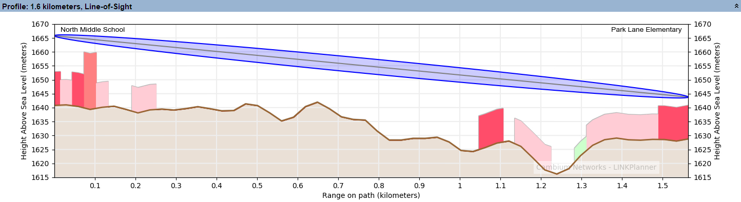
Path Profile (Unlicensed)
Check that the profile is accurate and identify any obstructions that may affect signal quality.
The profile can be verified using Google Earth(TM), maps, GPS data and site visits. It is particularly important to verify the antenna heights, to measure interference and to identify obstructions near both ends of the Fresnel zone.
For more information, see Using Google Earth(TM).
Double-click on the profile. The Profile Editor is displayed. Enter a 12 meter high Obstruction at Range 0.649 km and increase the height of the clutter at Range 1.091 km by adding a 9.5 meter high Obstruction as well.
The + and - buttons may be used to add and remove points. For more information, see Updating Link Profiles.
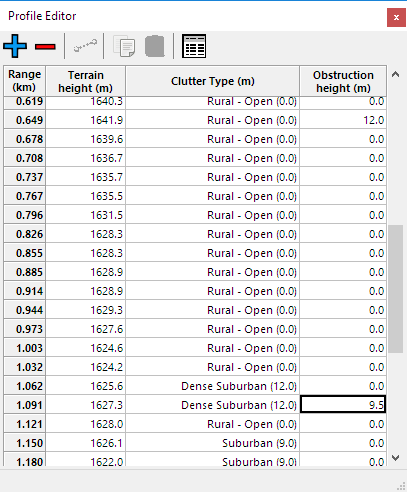
Profile Editor (Unlicensed)
Review the profile. Obstructions are shown in yellow.
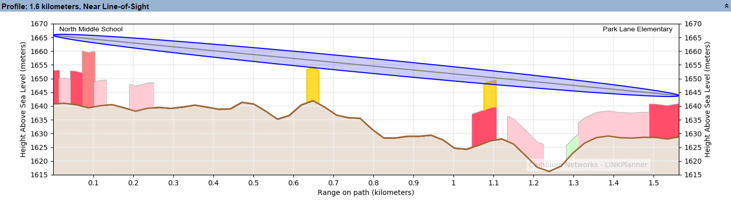
Path Profile with Obstructions (Unlicensed)
Click Save Project
